Peg’s Web Site for Information on X-C Skiing near Brian Head and Weather/Road Conditions
Here are some useful links that could help you if you plan a trip to Brian Head for X-C skiing or snowshoeing:
Brian Head Resort - this link allows you to see what the resort says the snow conditions are like. Take the “new snow” total with a grain of salt. They tend to overestimate. Also check out the live webcam at the bottom of Giant Steps.
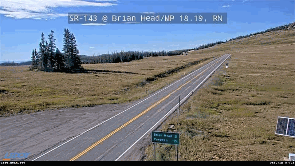
The webcam on highway 143- this will give you one look at conditions at the higher elevations of Cedar Breaks.
The UDOT weather station near Cedar Breaks north entrance; unfortunately, this station may be non-functioning because of severe weather. In the top window, page down through the tabular data and look for the green OK. If yellow CAUTION, or red SUSPECT, the data is unreliable.
Look at the radar map for approaching weather conditions. Also see the Brian Head microcast, for the forecast. Note that the temperatures are generally for a lower altitude than Cedar Breaks, so adjust your expectations accordingly.
The UDOT road conditions report - to see whether U-143 is open beyond Brian Head. Page down to Canyons, etc. outside the Salt Lake area and check SR 143, Brian Head to Mammoth Creek.
The following links allow you to download maps showing some X-C ski trails near Brian Head and Cedar Breaks:
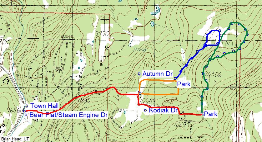
Burt’s road to nowhere begins north of the Brian Head Town Hall and goes about 4 miles in to several large meadows, the first known as the Pioneer Cabins. The other meadows lie at a bit higher elevations (download pdf).
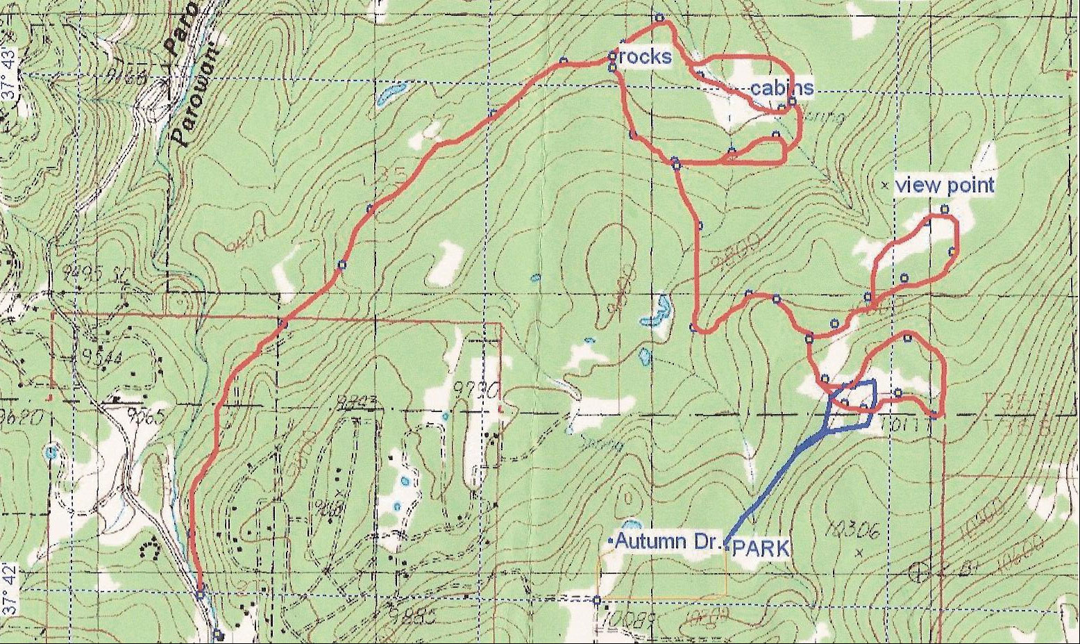
Driving up the Bear Flat Road (possibly to be renamed Steam Engine Drive) to the Steam Engine Meadows development, one can find trailheads (unmarked and unofficial) at the intersection of Kodiak and Highland and at the top of Autumn Dr. These trails also go into the upper meadows that one can access by Burt’s Rd (download pdf), in a much shorter distance, and provide some lovely views out toward the west and north. This area will soon be developed, but this year, the roads are not plowed and provide some nice peaceful skiing.
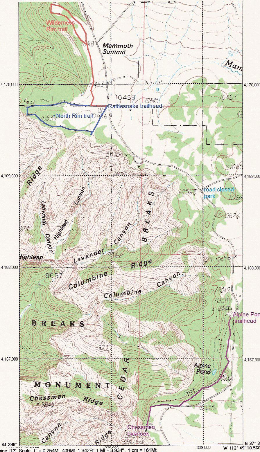
Driving south past Brian Head on U-143, one reaches near mile marker 18 a kiosk at which the Wilderness Rim and North Rim trails begin. Each is about 1 to 1.5 miles long and easy skiing, but not groomed. The North Rim has been marked with orange poles this year, and the parking lot is supposed to be plowed and is designated for “no trailers”, so should be available. When 143 is closed, the area is easy to access from Brian Head by parking at the south edge of town near the Welcome to Brian Head sign, but one does have to walk about ½ mile up the road, to just past the guard rail. The North Rim, in particular, has beautiful views of Cedar Breaks (download pdf).
About a mile further south on U-143, just as U-143 branches left toward Panguitch, there is a parking area straight ahead, where U-148 through Cedar Breaks is closed in winter. From this parking area, one skis south on the road (sometimes groomed, but shared with snowmobiles) about 1 mile to where our Yurt sits. Adjacent to the Yurt is the beginning of the upper Alpine Pond trail. This trail, extending about another mile south to the spectacular Chessmen Ridge viewpoint, is marked by orange poles (download pdf).